Thursday, 2 May 2013

South West Coast Path Section 17 Porthcothan to Newquay


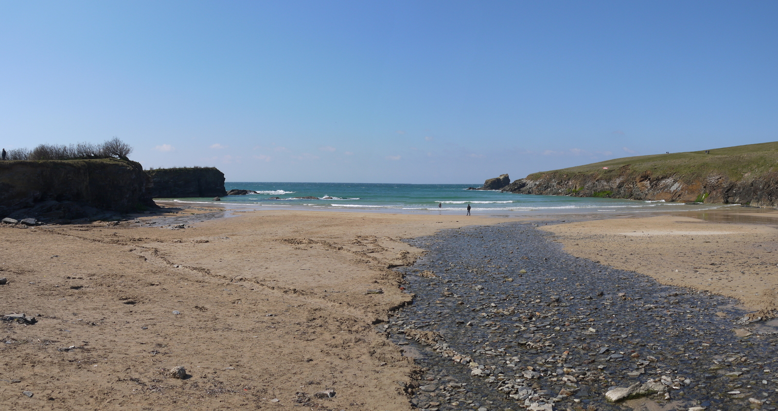
Porthcothan Beach
Looking at the long range forecast and I can see that this week is going to be very testing and casting around for anywhere in Devon or Cornwall that had some sunshine was quite difficult today. As luck would have it one of the few bright points was in Newquay and this was pleasing as it provided an opportunity to close a gap that I had created at Porthcothan just a few days before. I cannot claim the weather would be anything like as good today as it was back then but it did at least look as though it would be dry for most of the day & have a few sunny intervals, unlike anywhere else I could find.
Trescore Islands


I managed to find an on-street parking space at the eastern end of Newquay, a commodity that I suspect is very rare on good weather days. I walked over to the bus stop and had only a few minutes to wait when a double decker bus pulled up. I didn't think much of this at the time, but as we progressed through the ride to Porthcothan, I soon realised that this was an absolute monster to be taking along some of the lanes that the route took. I was certainly glad I wasn't driving!
Park Head View
I got off at the point where I had finished my walk three days earlier and was pleasantly surprised at how much warmer it was compared to the last few days. I walked alongside the extensive beach at Porthcothan and was pleased to see a few hardy souls had also ventured out for some air on this Monday morning.
Arch at Park Head
The going was pretty easy to begin with, climbing slowly on low cliffs. I soon became aware that the cliffs were not all they seemed as there was a gap of sea between myself and the rocks and I soon realised that I was looking at some rocky islands. Apparently bottlenose dolphins occasionally come inshore near here but I wasn't lucky enough to see them.
Bedruthan Steps
I was soon down at sea level again, crossing a small valley and cove known as Porth Mear. It did seem a lot rockier than many I had encountered but I was thankful that it hadn't been a major descent and ascent. On the far side the path climbed steadily once again until I reached the viewpoint of Park Head. I didn't head out to the end of the Head as the path by-passes it. The view ahead was starting to open up anyway as I had reached the top of the slope.
Relaxing Tussock
Ahead was an astonishing landscape. This is the famed beach of Bedruthan Steps, although I was seeing it from a rather different angle than is usual. My onward route took me along a relatively level clifftop above the famous beach for about a mile or so. Almost every step of the way the view changed as the clouds shifted around with hints of sunshine every so often.
Mawgan Porth
At the far end near the visitor centre I was joined by a lot more tourists who had come here by car and were content with getting the famous picture and heading off to the next place. The steps down to the beach were open (they close during the winter months) and a few hardier visitors were wandering about on the beach.

End of a Hard Day
I continued on my way after briefly admiring the view and soon lost the tourists. My path was relatively straightforward along the side of the cliff until eventually I dropped down onto the beach at Mawgan Porth. As I did so I looked out for the small linear depression in the landscape that my Guide Book suggested I would cross. Sadly I never saw it but it was apparently a hairbrained scheme to build a canal from this point across the countryside to Newquay, carrying with it sand and agricultural goods. Because of the terrain around here it was to operate as a tub boat canal system, with inclined planes replacing conventional locks. Unsurprisingly the venture, although started was never completed and so we'll never know for sure whether it would have been completed. An interesting history can be found at http://www.newquay.oldcornwall.org.uk/articles/edyvean.shtml

Beacon Cove


At Mawgan Porth I took the opportunity to pop into the shop that I had seen on the bus over here. It was slightly odd, resembling a petrol station and yet I suspect that it had not functioned like that for many years. The shop itself was pretty well stocked and I was grateful for that.

Tregurrian Beach
After buying provisions I made my way along the other side of the beach and found myself a nice place to sit on the cliff edge where I could consume my lunch and watch the activities going on down on the beach. There were a few surfers and a couple of dog walkers but the beach, along with most I have seen so far have been largely deserted. Feeling fortified after a few minutes I pushed on. The next part of my cliff top walk was less easy. the path wound its way around a couple of large coves and took a couple of ascents and descents as it did so, leaving me a bit breathless.
Landing at Newquay Airport
I was pleased to see the sun finally burst through at this point and many of the clouds drifted away to reveal some blue sky at last. I felt truly vindicated! I was especially pleased when the path settled down once again to a more level course. As I approached Trevarrian I was startled when a passenger plane roared up behind me on its final approach to Newquay Airport. This is becoming a busy little airport now, with three departures to London Gatwick every day and to many other destinations too.
Trevarrian Development
I dropped down off the cliff briefly At Trevarrian, where I passed a very large looking new development. This part of the Cornwall Coast does seem very popular, I imagine these new places to stay would be for the surfing crowd? I passed by the busy car park on the other side and continued along the cliffs on the other side. This proved to be an agreeable section, although if I'm honest all the interest was down on the beach rather than on the top of the cliffs. Newquay seemed to get very close all of a sudden,probably as a result of me constantly looking down at the beach!

Porth Island Bridge
Eventually I reached the wonderfuly named Whipsiderry, where the path was supposed to head out towards Trevelgue Head. Sadly this part of the path was closed for yet more landslips and I had to continue along the road instead. I crossed the river and passed by a pub that had the biggest anchor I have ever seen adorning the outside. Luckily I had my wits about me a little further on because the coast path ducked down and underneath the road I was walking on. I headed alongside Porth Beach and realised that when I looked across at the headland that I hadn't managed to walk around due to the path being closed was in fact part island, joined only by a small footbridge.

Lusty Glaze
I continued the last part of my walk into the centre of Newquay for completeness sake and then double backed to retrieve my car. On the whole this was a satisfactory section with the undoubted highlight being the Bedruthan Steps. The rest of it was pleasant enough but could hardly be described as a top drawer section.

Sunday, 28 April 2013

South West Coast Path Section 35 Par to Fowey


Par Beach

During my student days I walked this section and the next combined for a fairly lengthy but very rewarding day out. On that occasion I picked a lovely early summer day in 1995, but conditions today could not have been more different from that occasion or indeed the previous day on the Rame Peninsula. I deliberately kept today's outing fairly short and on a section of path I knew principally because of the wild conditions. Call me soft in my old age but I get no satisfaction from walking in the wind and rain for very long and certainly wouldn't choose to. In fact I think it is fair to say that if I had been at home I probably would have given today a miss altogether.


Par View
It was Sunday, a day which severely limits options on the Coast Path if you rely on public transport as I do. Basically I had two options today using the same bus service - either Mevagissey to Par or Par to Fowey. Given that the weather forecast looked so very dicey I opted for the latter. This is a fairly short section of only seven miles but it does include a wonderful headland along the way.

Polkerris
I started my outing from Par station, where it was a lot easier for me to park the car. Par is a bit of a nothing sort of place, mostly bungalows and houses built in the 20th Century. Walking down to the beach though was a most pleasant experience as along the way at regular intervals I seemed to get the smell of freshly baked pasties up my nose. So far the weather seemed fairly benign and I wondered whether I was making the right choice. However, when I eventually got to the beach I realised that I definitely made the right choice. A cold blast of air suddenly caught me and made it difficult to even stand up! I walked along the dunes hoping for some quick relief!

Polkerris Harbour
As I got to the main car park I found my first disappointment for the day when the onward path to Polkerris was closed for a landslip. The alternative route was via the Saints Way up to the top of the hill and back round via the road. This added a small amount of distance but also was considerably less staisfying than plodding along the side of the cliff. One thing I did get at the top of the hill though was a great view back across Par. Less agreeable was the short main road section that followed but fortunately this was mercifully short.

Polkerris Landslip
I dropped down the very steep road into Polkerris, fascinated by need for double yellow lines all the way down the road. Given that the road is barely wide enough for a car I wondered whether anyone would be stupid enough to park right in the middle? At the bottom of the hill there was much sweeping up going on from one of the pub workers at the Rashleigh Inn. I had been advised that I should visit but sadly it was not open when I passed by. I went down onto the beach to take a look at the small harbour where pilchard used to be landed. As I gazed along the coast I should have walked I could immediately see where the landslip problem was. Hundreds of tonnes of rock had given way and now formed a large mound of material on the beach for the sea to work at some more.

Little Gribbin
There seemed to be very little life in Polkerris on such a bleak day, but the businesses were doing their best to gear up for whatever tourists might be about. The surf shop was open and the eateries were getting themselves ready for lunch. One or two people were milling around but I didn't hold out much hope for any of them having a busy Sunday.

Gribbin Navigation Marker
My onward path involved zig zagging up through the woods onto the cliffs once again and I couldn't help noticing how many dog bags had been left lying around. I've never quite understood the mentality of a dog owner picking up behind their pooch, only to then discard the bag. Surely it would be better just to leave the poo in the first place? At least it would break down.

Gribbin View to Polridmouth
At the top of the cliff I was once again joined by the wind although fortunately it was mostly behind me rather than in front. The onward path to Gribbin Head was largely forgettable compared with most of the path. I passed along the sides of empty fields lined with gorse bushes for a couple of miles. The path once again got interesting when I reached Little Gribbin, when once again I was faced with sheer drops of craggy rocks on my right hand side. As I approached the Navigational Tower at Gribbin Head I was surprised by a stoat that ran across my path. It had been many years since I had seen one of those!

Polridmouth
Gribbin Head is dominated by the red and white candy striped Navigational Tower that sits at the top. It was only ever intended to be a daymark and has never been lit. For sailors it was made to look significantly different from Dodman Point and St Anthony's Head to aid navigation into Fowey Harbour. I was once again greeted by incredible wind at this point and didn't hang around too long.

St Catherine's Castle
Luckily I didn't have to stay up high for too long for the path headed down the other side of Gribbin Head to the more sheltered cove called Polridmouth. Fans of Daphne Du Maurier may be interested to know that the beach house here is the original one that inspired the one in the novel Rebecca. With the little lake behind it, the house is in a beautiful setting and I could see how it would be inspirational. I was quite intrigued by the little weir outlet from the lake into the cove. As the water flowed down into it, the wind was doing its best to blow it back up, creating an interesting looking phenomenon.

Fowey Harbour
Despite being very close now, Fowey seemed never to come due to the slavish sticking to the coastline of the path. I wound round and round different coves and up what seemed to be a steep slope although in reality it was probably nothing of the sort. I think the wind does that to me,it makes me feel prematurely weary and is probably my least favourite weather to deal with over a long period of time.

Polruan Ferry
Eventually I came upon the ruins of St Catherine's Castle, one of the so-called 'Device Forts' commissioned by Henry VIII. I took a little time to look around the ruins, although it was extremely cold and I didn't want to hang around too long. I pushed on into Fowey itself and took some time to look around the shops and get myself some lunch. It was actually quite pleasant not having the pressure to continue as I had done last time I came this way. The little ferry across to Polruan was running and seemed to be doing a reasonably brisk trade. I contented myself with leaving that section for another day. I do know how lovely the next part of the walk is and it surely deserved a much better day. Perhaps this section did too, for the view from The Gribbin was marred by the wind.

Wednesday, 24 April 2013

South West Coast Path Section 38 Whitsand Bay to Cremyll

View From Whitsand Bay

 Back when I was a student in these parts I undertook this as my first lengthy section of the Coast Path after a few flirtations with the south east Cornwall part of the walk. On a bright and sunny April day back in 1995 I took the plunge and walked from Plymouth to Looe, a distance of 21 miles. I was hooked from that point and vowed that I would one day complete the whole thing. Since I restarted the walk back in 2006 I have been journeying in the opposite direction and the idea of walking 21 miles in a day along the Coast Path is not something I would do now. Partly this is a lack of faith in my own fitness and partly because I like to take my time and enjoy the view now I'm a bit older! It made sense to me to split this section in two almost equal halves and I chose Whitsand Bay as a place for a staging point. There were no buses directly from Cremyll to Whitsand Bay on a Saturday so I parked in Cawsand Square and got the bus from there to my starting point.

Rame Church
I have very fond memories of walking this section of coast and I picked an ideal day for my nostalgic trip. What I hadn't banked on though were path diversions from the very beginning; I assume for landslips? This seems to have become a pretty common problem, particularly along the south coast of the route. Much of the route through where the Whitsand Bay huts are was largely along the road rather than along the cliffside, which was a bit disappointing.

Daffodils
Nevertheless I made some quick progress and so took the opportunity to make a detour so that I could go and look at Rame Church,sonmething I had meant to do for a long time. It is only just off the path and the spire can be seen from a considerable distance away. Despite walking within half a mile of it for years I had never ventured to look inside. The spire is certainly unusual in these parts - most churches in this area have towers. Inside the church is beautifully kept, but with such a small local population the congregation must be very small? Outside the churchyard was bedecked with fresh primroses & daffodils making the rather austere gravestones look a little cheerier.

Rame Head Chapel
On the way back down to Rame Head I wandered along a lane that wove its way between fields of daffodils, a sight that I have only ever seen in Cornwall. It certainly brightened my mood seeing their golden yellow splendour. At the end of the lane the volunteers for the local Coastwatch Institute were getting ready for their day's shift in what I assume used to be a coastguard station. There were also a couple of walkers around, looking for birdlife judging by the paraphernalia they were carrying.

Rame Coast
I made my way down to the chapel on the top of Rame Head. This small chapel is said to date from the 1390s but may occupy the site of a much earlier hermitage. It is practically impossible to pass by without making the short journey up to it. Most of the timewhen I took the Cremyll Ferry across from Plymouth this would be my destination for the afternoon's walking. I sat by the chapel for a few minutes enjoying the view. From this point it is possible to see as far away as Looe and Polperro to the west and Wembury in the east. Strangely, given its proximity it is not possible to see Plymouth. As well as the chapel there is also a fairly large flat area at the seaward side of the chapel, I assume this was for a gun battery. It certainly would be a good defensive position.

Penlee Point
Eventually I clambered back down the slope to continue my journey towards Cremyll. Being at the highest point of the walk I knew it would mostly be downhill from here! The next mile or so was particularly easy down to Penlee Point, wandering down between walls of gorse bushes and a few Dartmoor Ponies doing their best to try and keep the vegetation down.

Kingsand
Penlee Point marks a transition from the wild coast of the southern end of the Rame Peninsula with the wooded sheltered side on the western shore of the entrance to Playmouth Harbour. I had remembered that there was a small chapel also at this point but it is below the level of the path so I clambered down to inspect it. The positioning of the chapel is rather odd & I would have more imagined a military installation here. There is one, but it is down at the shoreline far below and surely cannot command the same sort of view?

Devon Corn
I turned to head down through the woods to the village of Cawsand, where I would actually be staying for the rest of the time that I am down here. I wanted to live in Cawsand while a student at Playmouth and although I number of people that I knew did just that, for me it ended up being too impractical to my great disappointment. It was a most pleasant walk through the woods and I was glad to be out of the direct sunlight for awhile, for it was getting quite warm.

Approaching Mount Edgcumbe
I reached Cawsand quite quickly and resisted the temptation to jettison a lot of my stuff at the car, for it was now quite warm. Every now and again though was a chill breeze and I thought it best to keep everything with me. Although the character of Cawsand and its twin village Kingsand remain almost exactly the same as I remembered I was sad to see that a number of businesses seem to have folded, notably an inn I think called The Ship, where I had stayed on the occasion of my graduation. Indeed the old place looked in a fairly sorry state.

Earls Drive
Kingsand and Cawsand are almost indistinguishable from one another, but before boundary changes moved the Devon/Cornwall border to the far more sensible River Tamar, the boundary used to run between the two villages, with Cawsand being in Cornwall and Kingsand in Devon. The coast path follows the narrow streets through the two villages and you have to keep your wits about you to make sure you get the right road in the labyrinthine streets.

Warship Arrival
Almost opposite the Rising Sun (surely the best pub in either village) the path leaves to head across Mount Edgcumbe Country Park. I was back out in the sunshine now and beginning to regret my decision not to leave someof my stuff behind. Initially the path is quite straightforward passing through a lovely grassy area where people were out playing, walking their dogs and sitting and watching the sea. The path continued in this manner for about a mile until I came upon a road, which heads down to Fort Picklecombe (a military installation turned residential complex). I crossed over and found myself going up a narrow path between enormous gorse bushes.

Mount Edgcumbe Grotto
At the top I joined the Earl's Drive, a rather similar feature to the Hobby Drive that I had walked along a few days ago. It used to be that this would be followed back to the edge of the more formal part of the park but now a diversion is necessary due to one of those landslips that seem to have plagued this coast. I noticed that around Fort Picklecombe, which used to be out of sight down on the shore, much of the woodland has been cleared opening up this view once again. I seem to recall that most of the 'woodland' was in fact rather out of control rhododendrons and the clearance seemed to have focused on taking these out. The diversion enabled me to see something I hadn't previously seen too - a three arched grotto high up on the hill in the woods.

Mount Edgcumbe Folly
As I had zig-zagged up the hill to find the grotto, so I needed to zig zag back down again, crossing the Earl's Drive as I did so and seeing the mess that the landslide had created. The path continued downhill through the woods almost to the shoreline. I'm not sure this was necessary or an improvement, for the path got decidedly boggy at the bottom and although some attempt had been made to rectify it, I was not very pleased about this part of the diversion as it seemed unnecessary and badly thought through. I noted that people were still walking on the Earl's Drive high above me. I took a detour at this point to climb up to one of the iconic buildings of Mount Edgcumbe, the folly that overlooks the harbour. I made my way up to it and admired the view from the top.

Plymouth Panorama
With a blast of its horn the warship which had been following me to Cremyll made its final approaches to the Naval Dockyard over in the distance. For me it was my final approach too as I headed down into the more formal part of Mount Edgcumbe Gardens. Sadly, although it was a fabulously sunny day, the season had not properly kicked in and many of the flowers that I would have expected were either stunted looking or yet to flower. Any possibility of getting some refreshment at the Orangery was also dashed as it was being used for a wedding. The bride and groom must have been thanking their lucky stars that they chose this of all days for their wedding!

Orangery
I got to Cremyll with a few minutes to spare before the departure of the bus. There was no sign of the ferry but plenty ofpeople having lunch at the adjacent pub. I whiled away the last few minutes reading the noticeboards describing the history of the ferry that I had used so many times to escape from Plymouth. The ferry has run between the two points since the 1100s - quite a period of operation! No need for me to use it today as this would be my journey's end after my trip of nostalgia. I have no doubt that I shall do this stretch of the Coast Path a few more times - I have such an affection for it.

Saturday, 20 April 2013

South West Coast Path Section 16 Padstow to Porthcothan

 
Padstow Harbour

It was a stunning day albeit with a brisk wind and I felt like I needed a slightly easier walk today after all the ups and downs of the last two sections. With the weather forecast suggesting it might change to less agreeable conditions later I decided to head down the coast further to Padstow. I was slightly nervous of continuing from Hartland with no back up as the section to Bude is reputedly the hardest of all the sections of the route.

Former Padstow Station
I had heard that Padstow is not the easiest place to park so I took the car to the end of the route to find a fairly extensive and expensive car park at Porthcovan. Looking at the prices charged at these car parks versus the number of visitors to these parts during the summer months and the Parking Services Department must rake in some considerable income for the Council.

Rock Ferry
I took a double decker bus over to Padstow on what could only be described as a nerve jangling trip. The bus seemed far too big for the route, although I very much enjoyed the view from the top deck. We were dropped at the end of the Camel Trail in Padstow by a building that I immediately recognised as being the old station and one of the destinations of the famous old train The Atlantic Coast Express before it became a victim of the Beeching cuts. The Camel Trail follows the old railway along the banks of the River Camel towards Wadebridge and on to Bodmin and must surely one day be a future project for me?

Sand Snipe
I wandered into Padstow, or PadStein as it should surely be renamed? The TV Chef Rick Stein is famously associated with Padstow but I had no idea of his sphere of influence in these parts until I saw the number of outlets that now carry his name. I wondered whether the town hoists a flag to denote he is in residence? I stocked up on provisions, with the inevitable steak pasty (after smelling them I couldn't resist!) being taken away for my lunch.

Walking down the Camel Estuary
Suitably supplied I was now ready to commence my walk and the first part was along the banks of the Camel Estuary. Ordinarily this would be the sheltered part of the day's walk but on this occasion I had a stiff north easterly wind blowing directly into my face. On the odd occasion when I managed to duck behind some vegetation the air temperature was quite warm. As I wandered along I could see that this path was a popular one with strollers, presumably taking themselves up to the high point of Stepper Point, which was my first destination. I amused myself by watching the dredging operation being carried out by a vessel called Sand Snipe and then later some kite surfers taking advantage of the brisk winds coming through the channel.

Kite Surfing in the Camel Estuary
It was far from a straight path to Stepper Point as I had to negotiate a couple of coves along the way. The first was characterised by marshy conditions that needed a boardwalk while the second (Hawker's Cove) housed the original lifeboat station, still intact but now a private house. The lifeboat moved from here as it was ineffective at low tides and could not negotiate the notorious Doom Bar.

Hawker's Cove
At Steeper Point I turned direction to start heading westwards and was battered by a blast of wind as I did so! The path did a lop around the headland and up to an old tower that had been built nearly 200 years ago as a navigational aid for sailors. Curiously it offered no protection whatsoever from the wind when standing inside! I imagine that it does act as an effective landmark still for sailors in particular.

Navigation Tower
My onward path was relatively straightforward but I had one of those moments on the path when my heart sank a little. Walking 10-12 miles is not tough for me, but seeing that distance stretch before you on a coastal walk is a little daunting. Away in the distance I could see the peninsula of Trevose Head, where I would have to walk around long before the end of the day's walking. It looked a very long way away! I decided to eat my pasty and take a few minutes to contemplate the sea before continuing. On days like this I could sit and watch the waves crashing in for hours - they are mesmerising!

View From Roundhole Point
The walk along the top of the cliffs was refreshing and my pace quickened along what was a fairly straightforward path. Down below me I could hear the crashing of the waves and the seabirds wheeling around in the stiff breeze. Many appeared to have found nesting spots on offshore rocky islands that only they could inhabit. Sheer cliffs all around offered plenty ofprotection from interference.

Sheltered Beach
Just before coming to the village of Trevone I came across a curious feature - a collapsed sea cave imaginatively called Round Hole. The sea had obviously penetrated underneath to such an extent that the roof had eventually collapsed, leaving nothing but a yawning chasm. I did try to photograph it but I could not adequately capture its scale.

Trevone Bay
The beach at Trevone was small but sheltered enough to accommodate some more adventurous holidaymakers who seemed content to be sitting on the beach with their anoraks on while the kids built sandcastles. A babbling stream seperated the two halves of the beach and this also provided some amusement to the kiddies.

Keeping Safe
A more substantial beach was reached at Harlyn a mile or so further on. I amused myself watching the surf schoolers being put through their warm up routines as I passed by. I also passed the first of many metal detector enthusiasts who was desperately trying to dig up the lost treasure that he thoiught he had found. In the middle of the beach was a large RNLI lifeguard vehicle watching the few brave surfers who were out in the water. Unusually the path used the beach for its route for a short while and I headed down to the water's edge to walk on the wetter and harder sand that is easier to walk on than the dry and loose kind. As I did so I passed a young family who were playing dare with the waves rolling in. This was a bad move as the very small children weren't quick enough to race them and the little girl soon got a wellington boot full of seawater which I am sure ruined her afternoon!

Surf School
In truth I was relieved to climb the steps and get back onto the cliff. I followed the back of the beach for some distance before reaching a mini-headland (Cataclews Point) and changing direction. I was now faced with a view of the new lifeboat station that replaced the one I had passed earlier. It had a much more sheltered position, but quite a steep ramp down which the lifeboat needed to be launched.

Surf's Up!
Just past the delightful Mother Ivey's Cottage the path struck away from the coast straight uphill to the end of the headland and cutting off the section of coast where the lifeboat station is sited.This confused me a little to start with, but I was reassured by seeing other walkers ahead of me. In the far corner of the headland was Trevose Head Lighthouse, built in 1847 and like all other lighthouses in the UK now automated. Unlike the lighthouse at Hartland Point that I had seen yesterday, this one has four cottages attached that would once have housed the lighthouse keepers. They are now available for rent as holiday cottages.

Trevose Head View
Just past the lighthouse and I passed another round hole, just about the same size and shape as the one I had passed a few miles earlier. Otherwise it was a pleasant and gentle stoll along the much lower cliff line on this side of the headland and past the wonderfully named Booby's Bay and Constantine Bay until I reached the village of Treyarnon. There were a few people milling about here, mostly rockpoolers and people walking their dogs.

Padstow Lifeboat
Opinions seem to be divided about where to finish this stage of the walk. The official guidebook suggests here (presumably because of the prominent Youth Hostel that I passed), while the website suggests Porthcothan. I chose the latter mainly because that is the place where the bus passes through. Since the weather was so fantastic I wasn't in a great rush to finish in Treyarnon anyway and eagerly continued along the cliffs out of the village.

Trevose Head Lighthouse
This last section was very much more like the part that I had started with; high cliffs and deadly drops within metres of the path. Below I could see jagged rocks on which a number of ships have foundered over the years. An old tanker called Hemsley 1 was supposed to be at the bottom of the cliffs at Fox Cove, but I couldn't see any remains. Apparently the old thing ran aground in dense fog in 1969 as she was trying to complete her last voyage to the breaker's yard in Antwerp. The story goes that the crew completely lost their way and when they sent out their distress call they believed that they were off Lizard Point & it took some searching for the wreck until it was located. I had similar trouble locating it - either the tide was too high or I was looking in the wrong place.

Constantine Bay
Along this high level cliff path it didn't take long for me to reach Porthcothan. The guide book describes it as a lop sided kind of place and it is easy to see why. My approach to the village was along the undeveloped north side of the cove, owned by the National Trust. There are no buildings on this side and my final descent to the car was via gorse lined paths, a lovely end to the day's walking. Not the most challenging section of the coast path, but on such a glorious day it was thirteen miles of heaven for me!