Showing posts with label South West Coast Path. Show all posts

Thursday, 23 May 2013

South West Coast Path Section 20 Perranporth to Portreath


Perranporth
A couple of years ago when I was down this way I had managed to arrive before the summer timetable of buses started and so was unable to complete the section between Perranporth and Portreath without some lengthy bus journeys between the two villages.  With one more day of good weather forecast I was determined to put this right on this trip and therefore closing the only gap between Padstow and Porthleven.  Even with summer timetables there was only a couple of buses a day and so I had the choice of starting a lot later than I would have wanted or the worry of making the bus at 4.30pm in the afternoon.

Droskyn Castle
In the event I opted for the latter option, thinking that I had more than enough time to complete the day’s walking with enough time to have a cuppa at the end.  Doing the trip this way round also meant that I would save about 25 miles of unnecessary driving.  I pulled up at Perranporth at about 9am and found an on-street parking spot, not wanting to be stung by the all day parking charge that I had done last time here.  Luckily it was early and gloomy enough that I didn’t have to worry about all the free spots being taken.

Shag Rock View
I made my way down to the cliff edge to reunite with the coast path.  It was windy and dull, not the sort of day I had imagined from the weather forecast at all.  I had to button myself up against the cold as I took a look across the beach and the rather novel looking sundial. It was rather impossible to tell the time on such a day though!  My way forward took me up past the youth hostel and a rather strange looking castellated building that I gather is now a hotel.

Interesting Rocks at Cligga Head
From this point on my walk took me along the wild cliffs that once housed a metal mining area known as the Cligga.  Initially the cliffs were rather similar to the last section along from Newquay, although I soon lost the beach below.  After a couple of miles though the cliffs were scarred from the pollutants generated by the mining activity and it looked as if some hasty engineering had to be put in place to prevent the path collapsing into the sea.  At Cligga Point the remains of the old mine buildings could be seen, although there mostly foundations left.  By now the clouds were blowing away, revealing some magnificent views ahead.
Former Mine Buildings at Cligga Head

Off to my left I soon became aware of the airfield off to my left.  Now largely deserted I believe it still has some use for pleasure aircraft and judging by the number of picnic benches provided around the perimeter and on the path I am guessing that the owners are trying to raise its profile a bit.

Hanover Cove
The onward walk to St Agnes was delightful, with the clouds blowing right away and the sun coming out in a blaze of glory.  The sea below was pretty choppy and I could see white horses on the water for as far as the eye could see.  Way out in the sea I could see a large tanker, anchored about 3 miles offshore and a sight that I would be able to see for the remainder of the day. 

Looking Back to Hanover Cove
Once past the far end of the airfield my clifftop walk came to an abrupt end at Crosscombe as the path dropped down into a steep valley that housed a couple more old tin mines.  The furthest one from the shore apparently still works and can offer tours around but when I approached I notice a sign saying that no tours were being offered during 2013.

Approaching St Agnes
I crossed the small river at the bottom of the valley and climbed up the steep slope the other side, an unmade road that was used for a regular motorcycle event that runs from London to Lands End (details needed here).  Walking across the rough terrain wasn’t all that easy so I couldn’t imagine trying to ride a motorbike across it.  Eventually I came upon the pretty beach and cove at St Agnes.  The village itself is largely up on the hill above the path but there is a beachfront of sorts and it was obvious from the galleries and other shops selling tourist stuff that there is enough in the way of summer trade here to keep people going.  Sadly the clouds had come back at this point and as I headed around to St Agnes Head I kept looking at the sky, hoping that they would shift in time for the main highlight of the walk, the famous engine house at Wheal Coates further along the path.

Trevellas Coombe
Although the walk up to St Agnes Head was quite quiet as soon as I rounded the headland and the coastwatch station on the top the crowds started once again.  Ahead and I could see the main attraction – the old engine house at Wheal Coates and surely the most photographed of all the engine houses in Cornwall?  The mine itself has now not operated for 100 years closing for the final time in 1913 after a short stint being reopened.  The original mine operated from 1802 until 1889 and the derelict engine house is now ironically a grade II listed building.  I cannot imagine a derelict structure from the late 20th Century being afforded such protection in a few years time.

Trevellas Tin Mine
The engine house itself was every bit as spectacular as I’d hoped.  I hung around for a bit waiting for the clouds to shift around enough that I could get some good pictures of my own.  I also had to wait quite a time to make sure I got all the tourists out of the shot too. Having a number of people swarming around the old place kind of detracted a little from how it looked.

Trevaunance Cove
I was relieved to drop down on the coast path away from the strollers and headed down into Chapel Porth.  The chapel wasn’t particularly obvious and I walked past it before I realised.  The hatch in the National Trust car park was quite busy although the menu wasn’t particularly promising so I decided to push on to Porthtowan instead.

St Agnes Head View
This involved yet another climb back on to the cliff tops for a short distance.  As I did so the weather relented once again and the sun made a welcome reappearance.  The rest of my trip today would be characterised once again by glorious clifftop views and by now the shape of St Ives came into view on the very far horizon.  Strangely though the ship offshore didn't seem to get any closer looking!  It didn't take long to get to Porthtowan and I entered the small beach resort past a swanky looking eating spot that seemed very popular today.  Most of the diners though were still inside, preferring not to brave the stiff breeze outside.

Wheal Coates
Upon seeing a small runabout bus waiting at the bus stop I decided to see if there were any more bus options since it was a lot earlier than I expected by this point.  I was delighted to note that there appeared to be an extra bus from Portreath back to Perranporth in just an hour and twenty minutes from now and decided that I would try and cover the remaining four miles in the time left.  I stopped in the shop and seemed to find the only one in Cornwall that didn't have any pasties for sale which was a huge disappointment.  The small number that were bagged up were allegedly for another customer.  The shop girl smiled sweetly enough so I like to think that me ending up with a sausage roll instead wasn't due to me being a 'foreignor'.

Chapel Porth
The sprint was now on and I put my foot down and motored the final section across to Portreath desperately wanting to get there before this elusive bus so that I could have an earlier return home later.  Initially the going was pretty easy and I made very good time along the mostly flat clifftops.  However, once past a large daymark my progress forward was interrupted by a couple of steep drops and equally steep climbs on the other side.  Yet somehow even these obstacles didn't really slow me down and I made excellent timing along here.

Looking Back to Wheal Coates
On the shore side of my path I became hemmed in by a fence surrounding what was clearly a military establishment.  There was a large installation that I supposed was for radar purposes since it looked like a rather big golf ball.  The rest of the base had an air of secrecy about it, with only parts of the buildings being visible and adding to the sense of mystery.  I understand that it has served as both an RAF station and a chemical warfare base.

Porthtowan
The last big coastal feature of the day was Gooden Heane Cove, a large area of cliff that had been scooped out by the sea and which seemed to be much favoured by the local seabirds.  Sadly for me the path down into Portreath was blocked by yet another cliff fall and so I took the less pretty but infinitely quicker road.  You can only imagine my frustration at reaching the bus stop five minutes earlier than the billed time only to find that I had been rushing for a phantom bus!  After a few mumbled expletives I realised that the bus timetable published at Porthtowan must have been out of date for the one here at Portreath seemed to have the bus times that I had been expecting.

Porthtowan Daymark
I wandered down towards the beach and holed up in the beachfront cafe for a mug of tea.  The sun was fully out now and it was enjoyable just sitting and relaxing after the effort I had expended getting here.  I now had two hours to kill before the bus!  The mug of tea was very welcome and strong.  At just £1 it was probably the best cuppa I had had in a cafe for years!  Importantly I could also easily afford a second.  I sat and watched the activity out on the beach, which for the most part seemed to revolve around hundreds of university students from East London.  I am guessing from their surveying equipment etc that they were either Geography of more likely Geology students.  A lot of them were taking up cafe seats which didn't please the prospective customers who couldn't find anywhere to sit.  Sadly their antics also meant that before long I too was on the move and decided to spend the rest of the time waiting at the bus stop reading the paper instead.


Gooden Heane Cove

This was a brilliant way to end my time away.  As with the last time I came down this way I felt that I still had plenty left in the tank for a few more days.  Sadly I don't know when I am again going to have the opportunity to get down here, but went home happy that I have now completed 420 miles of the whole hike and am therefore two thirds of the way to completion :)

Portreath

Thursday, 16 May 2013

South West Coast Path Section 34 Mevagissey to Par

Mevagissey Harbour

After a rough couple of days weather it was a relief to see sunshine once again and I was anxious to go and do a section of previously unwalked path.  I headed over to Par and from there got the bus to Mevagissey.  This was a bit of a long winded journey through St Austell and I think I saw every housing estate that exists in this corner of Cornwall.  I was most relieved to reach my final destination after an hour or so.

Maintenance Time
I stocked up on refreshments and wandered along to the attractive harbour in Mevagissey.  There were plenty of boats in the harbour but sadly little in the way of fishing activity, which I guess used to be the main activity here.  In fact the only activity on the water was a small boy precariously rowing a small boat around.  I could hardly bear to look as he looked like he would topple into the water at any moment.
Penare Point

As I wandered around the harbour I could see a couple of boats receiving some attention at the far end.  They looked faintly ridiculous out of the water and leaning over on their keels but I guess this is the only way in which they can be painted.  I wandered out on to the harbour arm of the outer harbour, a rather curious arrangement that I suppose was built to reduce the worst effects of the winter storms.


Pentewan
I could have spent a lot longer walking around the harbour but I still had twelve miles of walking in front of me so I headed out through the steep and narrow streets up on to the cliff tops.  The way ahead was a bit of a rollercoaster for awhile, with the path heading uphill and down dale for the next few miles.  I was thankful though for plenty of sunshine, which made a lovely change from all the grey skies I had encountered during the week.  I was surprised at how quickly I left Mevagissey behind and due to the direction that the coast path travels it disappeared from view very quickly.

Point of Well

Ahead the bay at Pentewan soon came into view, with its large expanse of holiday caravans behind the beach.  As a spectacle I am not a great fan of these places, but the location of this one must make it extremely popular during the summer months.  There wasn’t a great deal of activity on the park this early in the season, but there were a few people on the private attached beach.  I passed by an abandoned fishing station, one of many on this stretch. I believe most of them were involved in the pilchard fishing industry.  I am not even sure this exists any longer?

Stonechat

I passed along the back of Pentewan caravan park and headed into the adjacent village.  This was a peaceful and attractive place with the inevitable water sports shop as well as village shop.  What was unusual though was the artificial harbour built in the village.  I am guessing judging by its appearance that it is no longer used but in its day it was used by china clay traffic.  Now, the harbour is completely silted up and cut off from the sea.
Wood Carving at Drennick

The path left the village by a track that passed an old church and some beautiful looking houses that overlooked the bay.  At the back I by-passed some chaps renewing a boundary fence to the properties and thought what a lovely place and day it would be to work.  My way forward now was along the clifftops to Black Head, a promontory some distance ahead.  Along the way the path climbed and fell along an undulating course that was quite tough going.  The views more than compensated though and all along the way I was joined by all sorts of bird life and not just the expected seagulls but blackcaps, robins, blackbirds, sparrows.  I even came across another stoat – the second that I had seen on this trip away.

Black Head Cove
Eventually I came to the final headland of Black Head and the cove at the western end had the most delightful cottage overlooking it.  I am guessing that it must have been occupied by an artist at some point because there were two fantastic looking sculptures in the back garden that had been carved from tree stumps.  The cottage itself was some distance from the nearest road, which must make delivering stuff a bit of a challenge (can’t imagine Tesco sending deliveries there!).  I’m not sure I would want to live there full time, but as a holiday cottage I can’t think of many more idyllic spots.
View to Drennick

As I approached Black Head I passed by a very large and unusually plain looking memorial to the famous Cornish poet A.L.Rowse.  I took the opportunity to walk out to the headland even though it wasn’t on the official route.  I passed by another pilchard station on the way and headed up on to what was once an Iron Age Hill Fort.  These seem to be fairly common in Cornwall, something I hadn’t previously realised.  I guess the metal riches and plentiful fishing opportunities brought many of the Iron Age people down here and these headlands made for easily protected places to live.  Sadly I didn’t gain much from going out to the headland so I didn’t hang around too long.
A L Rowse Monument

As with all headlands though a new view opened up and ahead of me I could now see the china clay hills that I have heard being referred to locally as ‘The Alps’.  They do make for a rather unusual landscape that is unmistakably Cornish.  Across the bay and I could see the candy striped marker at the Gribbin.  As I looked I could see a helicopter buzzing towards me and as ever my immediate thought was that someone might be in trouble out on the water.  It rushed by looking like it was making a longer journey and I felt relieved.
Me at Black Head!

The onward route to Charlestown started out quite easy with some very pleasant cliff top walking.  I got distracted by the wild flowers growing along the side of the path though and shortly after passing a rare walker I took a wrong turn and started heading downhill towards Ropehaven.  I didn’t realise my mistake until I was almost at the shoreline and cursed as I had to retrace my steps up the steep path back to where I should have headed.  The bright sunshine that I had enjoyed for a while also gave way to cloud and I prepared myself for a rain shower, which thankfully didn’t come.
Silvermine Point

The onward path soon got a lot trickier with a couple of steep ascents and descents in quick succession including a pretty mammoth one at Silvermine Point.  I passed a couple of old codgers here and tried to not to show myself up by crawling up the hill they were taking slowly and steadily.
Porth Pean 

Eventually I came to Porth Pean, a beautiful secluded little beach that had attracted a few visitors on this rather unsettled looking day.  My guidebook suggested that I might need to head inland along a detour here, but to my relief the official path had now been re-opened.  I climbed some steep steps and found a lookout tower at the top which I couldn’t pass without a closer look.  A little further on and I could see the erosion that had precipitated the earlier closure and the fact that some of an adjacent garden had had to be commandeered in order to fashion a new stretch of path.

Earl of Pembroke at Charlestown
I stopped by at Crinnis Cliff Battery but by now the threatened shower had finally arrived and so I hurried down into Charlestown and took the opportunity to hunker down inside the shipwreck museum to ride out the rain.  It was a curious little place with a little on the history of the historic port of Charlestown.  This rather historic port has been largely by-passed but was once a hub for local china clay quarries and shipping out of the mined product.  It is now preserved in time and the image was complete with the visit of the Earl of Pembroke, a very attractive looking tall ship moored in the harbour.  Although there was some information about the harbour, the museum soon became a rather jumbled and confusing mish-mash of all things nautical including shipwrecks, rescue services and disasters at sea, some of which weren’t really associated with Cornwall. Perhaps the most interesting part for me was seeing the various wrecks around the Cornish coast, for some of them I had seen or heard about on my walks around the coast path.

Charlestown Shipwreck & Maritime Museum
After about half an hour of the museum I was ready to carry on.  I thought about having a cuppa in the adjacent restaurant but it didn’t really look the kind of place to just have a cuppa so I carried on.  The onward path from Charlestown wasn’t initially very interesting as I headed through the suburbs of St Austell, but I soon came upon a rather curious looking place on the area under the cliffs.  It was clearly going to be redeveloped but I couldn’t decide what it was.  It sort of looked factory like and yet it didn’t.  I later discovered that this was once an entertainment centre where large acts would once come and perform.  It had a successful life until a similar venue was built in Plymouth and no-one much fancied heading out into the wilds of Cornwall any more!
Approaching Par

My last stretch of coastal walking for the day was alongside a golf course.  A few hardy souls were out but I couldn’t imagine that playing golf on such a windy day would be much fun.  The wind though did bring up some wonderful sea and skyscapes for the next couple of miles until I came to Par.  At the china clay works the path headed abruptly inland and I had to negotiate around the edges of what now looked like a closed and derelict works.  Indeed when I checked later I saw that the bulk of the operation had been closed since 2007 and I am guessing that there will be quite a challenging time ahead for the local planners trying to find an alternative use for the extensive site.
View from Par Golf Course

For me though my journey was done and the weather had closed in once again.  Although perhaps not the most memorable sections of the coast path I really enjoyed my visit to Mevagissey and Charlestown was memorable too.  The best of the coast line was between these two places and especially around Black Head.  If time I would recommend the museum at Charlestown – despite the chaotic nature of some of the exhibits it is worth a tour around for an hour or so.

Monday, 6 May 2013

South West Coast Path Section 37 Looe to Whitsand Bay


Looe Station Welcome
Another re-walk today as I complete the second half of the section from Looe to Plymouth that I had once walked as one day.  This time I completed the section from Looe to Whitsand Bay and finally encountered my first rain of the trip!

Looe Harbour
I had a slightly more convoluted bus journey today as I had to take two buses via Liskeard, which meant rather more bus time than I would normally like.  However, I managed to get to Looe at a fairly decent starting time.  I had wanted to arrive by train but opted for the bus as the connections weren’t very convenient.  I did get off near to Looe station though and took a look at the very basic little terminus before heading on.  I’d forgotten that it is a modern affair and in fact doesn’t occupy the same location as the original station, which was once sited where the police station is now.  Nevertheless the line is a survivor of the Beeching cuts and has been thriving in recent years.

The Streets of Looe
I wandered into town and past what looked to be utter chaos as the roads were in the process of being resurfaced, which meant all sorts of closures of side roads and temporary traffic lights.  It did not look fun for drivers and I was glad that I had alighted from the bus early.

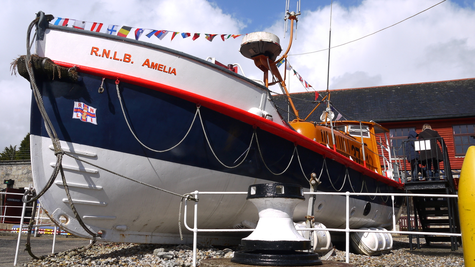
The Old Lifeboat Station
I got some provisions in town before wandering down through the narrow streets of this lovely town.  Looe is quite rightly a tourist honeypot in this part of Cornwall although on this rather miserable and grey morning the town seemed to be full of only locals and not tourists. I felt rather self conscious as I wandered down towards the seafront.

Looe Beach
Despite the drizzle that had already started there were a few kids on the beach digging in the sand seemingly untroubled by the weather.  Good for them I say!  I took a look at the lifeboat stations, old and new.  Both are striking looking buildings and it was good to see that a use had been made for the old one without being knocked down.  I climbed up the steps away from the seafront and along a pleasant if very damp tarmac path towards Millandreath.  This is a less appealing end of Looe, dominated by a rather uninspiring looking holiday park. To be fair it probably looks a lot better on a sunny summer’s day than it does on a grey spring one.

Ellie's Haven
The climb up and out of Millandreath was quite a tough one up a steep road, which eventually became a bridleway.  A hint of what was to come was provided by a sign warning of an uneven path and I could see what the problem was just ahead.  Part of the path had subsided and I guess with a bit more rain will probably give way entirely.  When I finally got to the top of the hill that is exactly what did happen to the next section, which I remember passing below the monkey sanctuary.  Sadly this whole section had been closed and I faced a very boring trudge along the lanes to get to Seaton instead.  I thought about wandering along the cul-de-sac of path still open but thought better of it.  The sheep in the next field, together with a curious robin all stared at me possibly wondering what my intentions were.

Crumbling Path
Seaton does not have the charm of its namesake in Devon, although the approach down the road suggested that it would be quite popular on a sunny day.  Even on this grey and slightly drizzly day there were a few brave souls on the beach.  I have come to the conclusion on this trip that there are a select group of people who just think ‘bugger the weather’ and get on with whatever it is they had intended doing.

Ramsons Flower
I crossed the low valley and headed along the narrow and rather scary road into Downderry.  This was a slightly more interesting looking place than Seaton and also had more of a community feel, with churches, a school and a shop.  Its main reason for being though is to provide housing with sea views and the village seemed to go on forever, strung out as it is along the coast road.  I didn’t even have the out of going down onto the alternative route along the beach front as that path was closed!

Cheeky Robin
Eventually after a bit of a scary walk along the road ducking into the edges as cars came along (the pavement was very intermittent, mostly non-existent), I finally started climbing up the hill at the back of the village.  I was most relieved to see that my onward route did not include any more road walking, for I was by now most frustrated by how much I had had to do.  I had remembered this section being heavy on road walking, but this has temporarily been made a lot worse by all the path closures.

Being Watched
The next section for me though was the highlight of the day.  The weather had relented and I plodded up the hill to one of the highest points on the south coast of Cornwall (a rather surprising place to find it!).  There were hints that I might even get some sunshine on what had been a resolutely grey day so far.  Climbing up to the top felt good as I got lungfuls of fresh air at the top.  The views along the coast were what I had come for and these were fantastic, unlike the earlier section along the country roads.

Dog Violet
At the summit of the hill I wanted to find St German’s Hut, mentioned in the guide book.  I spotted the long barrow in the field adjacent to the path and keenly looked around in the scrub on the coastal side.  It was just about possible to spot some ruins but they were completely overgrown and barely visible.  It was sad to see how the place had become – seeing an old picture of it later suggested that it was quite a place.  Originally built as a shooting lodge it later became a teahouse (although must have been a nightmare to service).  I am guessing that it has had no use whatsoever since at least World War II.

View above Downderry
From the hut it was mostly downhill to the next village, Portwrinkle.  It had by far the most character of any of the places I had visited thus far today.  I should by now be enjoying the great sweep of Whitsand Bay ahead of me but in truth it was largely lost in the mist.  As I approached the village I noticed a funny little white box in the field next to me.  Apparently this was once some kind of navigation beacon, but looking at it now I doubt whether it has been used in a while.

Approaching Portwrinkle
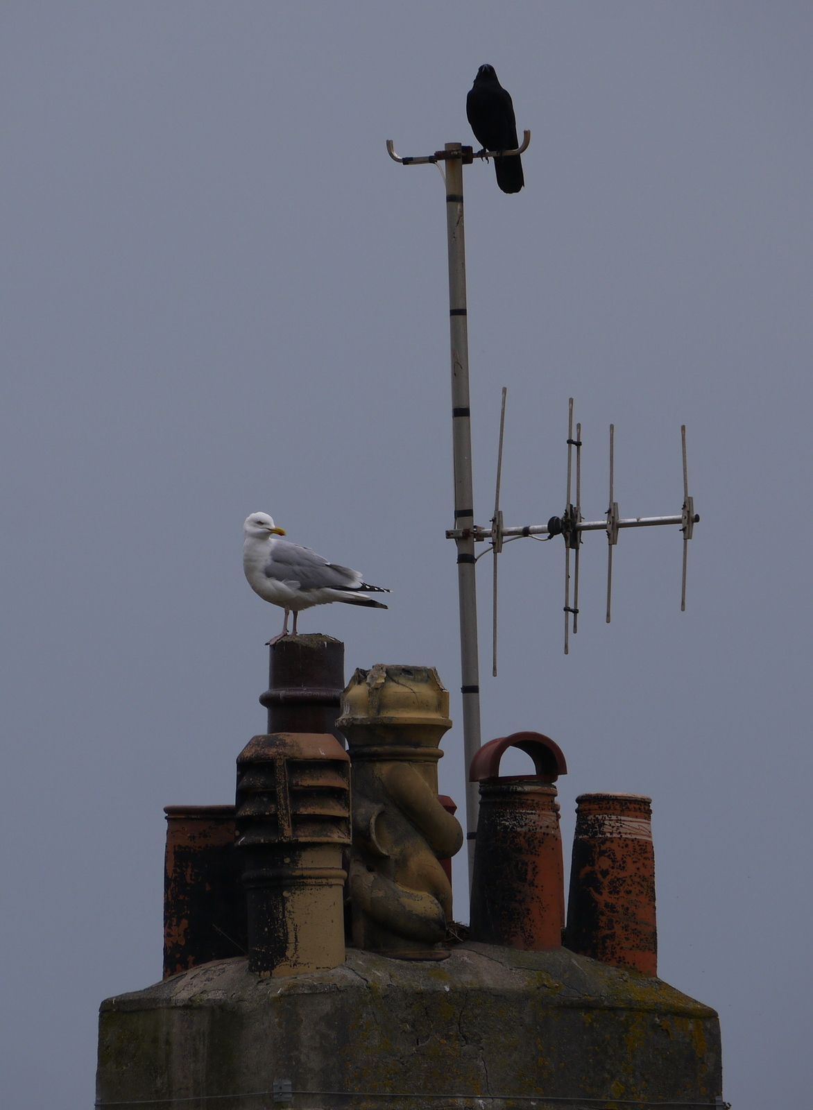
When I entered the village I notice a fair amount of birdlife.  I had already noted a few blackcaps en route but I was also serenaded by robins, chaffinches, blackbirds and sparrows as well as the normal range of gulls and crows.  I couldn’t help but smile as I noted what looked like a bit of a turf war between a crow and a gull on top of a chimney pot of one of the houses.

Stand Off
At Portwrinkle I was entertained by the surfers offshore.  There was one particular chap that I enjoyed watching that seemed to be quite proficient.  I am curious as to how these guys find the time to go out to play when the surfs up?  At the far end of Portwrinkle I passed by the Whitsand Bay Hotel, a striking looking building that surprisingly wasn’t originally built here, but in Torpoint about 10 miles away.  It was moved 30 years after being originally built, something of an undertaking in the early 20th Century!
Portwrinkle Surfing

I climbed once again up to the top of the hill outside Portwrinkle to continue alongside the golf course that must be quite testing when the wind blows!  Here I had a disaster with the camera as my battery ran out.  I then discovered that I had brought the ‘wrong’ spare, finding the one in my camera bag also out of juice!  I therefore had to walk the last couple of miles without any pictures to show for my efforts.
Whitsand Bay Hotel

It was especially disappointing as further on I was able to use an opportunity denied me last time I came this way.  A new path continues to the coastward side of Tregantle Fort, still very much a Ministry of Defence establishment.  Last time I came this way the fort seemed to be almost permanently flying the red flags denoting that firing was taking place in the rifle ranges.  Now the situation seems to be different – access seems more often than not.  This must be a relief to walkers as the previous route along the road was pretty unpleasant. 
Looking Back to Portwrinkle

The views of the fort are quite different from the coast side than from the road.  I was most disappointed that I couldn’t have taken any and despite my best intentions of coming back to take a few later on I never managed it and will have to do this another time I guess.

Whitsand Bay
This is a most frustrating section of the walk and I understand why it is often combined with the onward part into Plymouth as that section would definitely dilute its long sections of road walking and make them less memorable.  To have the batteries on my camera run out seemed to add insult to injury…