Sunday, 14 October 2012

South West Coast Path Section 53 Weymouth - Lulworth

Weymouth Town Clock
I was rather determined not to let the year slide by without at least one outing on the South West Coast Path and it seemed appropriate to visit Weymouth again before the end of the Olympics/ Paralympics.  Sadly I had already missed all the events that had taken place down here but with one day of the Paralympics still to go, I felt fairly sure that all the decorations would be up.  The weather was still very much summer season, although I did not think for a minute that this would last much longer. 

Paralympics Flags
Having explored the Weymouth Harbour Tramway, I turned to beach side of the coast and started the long walk along the Esplanade.  At the ferry terminal end of the seafront a large group of morris dancers and other folk-related groups of dancers were gathering and I took this to be an event marking the Paralympics.  Some of the groups had travelled some distance to be here, arriving from towns in Devon and Somerset.  They all made for quite a colourful group of people and the atmosphere was definitely one of anticipation for an exciting day ahead.

Flower Displays
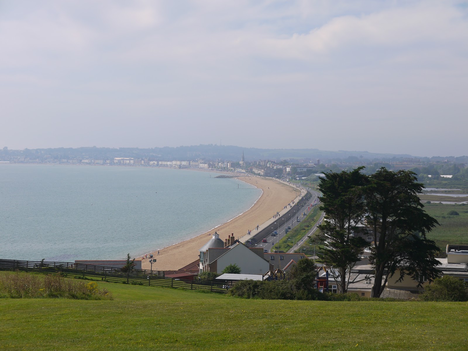
My sense of anticipation was also building as I headed around the great sweep of the Esplanade.  While I think that there may be other seaside resorts that are better equipped than Weymouth, there are few that can match its setting.  The extra money that had been spent on flowers, flags and other decorations for the sailing events that took place for the Olympics/ Paralympics really made the town look extra special.  It was slightly sad then to see the first of the stuff on the beach being dismantled a couple of days after the sailing events had finished.  It looked like there had been a big beach event the night before, which was being tidied away.  I guess most of the stuff has now gone as I am writing this a month late L.

Tortoiseshell Feeding Station
I dipped into town to grab some lunch before pushing on, finding that the streets in the town centre were a veritable flagfest.  The community had really gone all out to decorate the town for the visitors and the end result was every bit as good as anything we had seen in London.  Armed with lunch I went back to the seafront and passed the official Olympic store, which was now unloading the last of its stock before final closedown.  There were no final offers or knock down prices at this stage though, most of the souvenirs were still being sold at the fairly high cost that we had seen in London.  There weren’t too many takers…

Weymouth Beach Huts
The promenade was pretty busy now that the day had got going.  The early morning fog which I had encountered on the train journey down here was mostly gone.  Looking ahead along the stretch of coast that I had to walk today there was still a bit of low cloud hanging around the tops of some of the higher cliffs.  The sun had done its best to clear away the mist, but the day was definitely a hazy sunshine kind of a day, which perhaps wouldn’t be the best for views.

Bowleze View

I thoroughly enjoyed my wander along Weymouth seafront, which looked a most agreeable place to stay.  Certainly the hotels were an appealing bunch, with most of them traditional in architecture and welcome – no gaudy stuff here!  Eventually I came to the edge of town and for the last section of level walking along to Bowleze Cove the path continues along the protective sea wall.  At Bowleze Cove I left the road and civilization behind me as I climbed up and over the first piece of high ground for the day.  From here on I knew that my way forward would not be so easy.

Bowleze Cove
I climbed to the top of the hill and found a seat to stop at and grab my lunch.  Because of the vagaries of public transport between Lulworth Cove and Wool (where I had parked my car) I knew I would actually have a lot of time for exploring and sitting down, for I still had about six hours to complete the remainder of the twelve miles of walking that day.  As I looked out across the bay I felt a pang of disappointment that I hadn’t made more of an effort to come down here during the Olympics/ Paralympics to see our heroes claim a sizable share of the medals on offer.  As an amphitheatre it must have been an excellent place to watch proceedings, although as a non-sailor I would probably have been completely flummoxed by what I was seeing!

Bowleze Holiday Centre
The first hill proved to be no more than a starter for the day – I headed down into the bay below and passed a small fairground place, which I later learned was part of the adjacent holiday camp.  The main building of the camp was a 1930s edifice, looking pretty impressive standing on the side of the hill.  Apparently this place can get quite rowdy during the summer months, but all was quiet today.  I have a feeling that it might have served as athlete’s accommodation during the Games.  I thought this because of the official Games coach that was parked outside.

Osmington Horse

The path took a better route around the hotel than suggested in the guide book, taking the seaward side initially before bending back and taking an inland route on the other side.  I plodded up the next hill, Redcliff Point and stopped briefly at the top to look back at the view across Weymouth Harbour.  The countryside along this stretch of the coast had a decidedly autumnal look about it now – many of the summer flowers had set seed, blackberries were beginning to ripen and even the leaves on the trees were on the turn.  Yet, there was plenty of insect life about with bees and wasps in particular trying to extract the last of the nectar out of whatever flowers they could find.

Common Fleabane
On the landward side of the path I briefly got a very good view of the Osmington White Horse.  This rendition of a familiar theme was cut into the hillside in 1808 and unusually depicts a rider, said to be George III, the monarch who put Weymouth on the map during his reign.  It looked in great shape, courtesy of the refurbishment that took place in time for the Olympics.

Cinnabar Moth Caterpillar

A little further along the coast and I passed by what I took to be another facility provided for the Olympics and a rather surprising and random facility.  Out on the open cliff top was a temporary shower that had been fitted presumably alongside a campsite that was now entirely deserted.  Private showers would not have been the order of the day here, for each of the shower heads were totally open and not even cubicles were provided.  Not the usual thing you find out in the middle of the countryside that’s for sure!

Clifftop Showers
I soon came upon the hamlet of Osmington Mills, where my path linked up with the inland route that had followed its way from West Bexington along the chalk ridge to the north of Weymouth.  I soon realised that I passed West Bexington a couple of years ago – demonstrating how little progress I have made along the coast path since.  I didn’t bother visiting the shop that is to the north of the path, but had intended to have a quick drink in the pub on the route itself.  When I got there however, I realised that this wouldn’t be the pleasant experience I had hoped it might be because the pub was absolutely overwhelmed with diners and drinkers!
Redcliff View
I pushed on, through the beer garden and past a couple of holiday cottages that I made a metal note of.  These might be a really nice place to stay in future!  My route then took a slightly different and more remote feel than the busy stretch of coast that I had walked along thus far.  The countryside was more akin with that of the area around West Bexington, suggesting that I had now crossed into an area of different geology.  I was also alone once again, save for the odd walker.

Smuggler's Inn
The path briefly got busier again as I reached Ringstead Bay, a small settlement with some beautiful looking houses resolutely facing out to sea.  As with many other houses I have seen along this coast, many appeared empty, suggesting they were holiday lets or second homes.  I wandered into the village and found a refreshment kiosk, which was very welcome.  By now I was getting a little hot and bothered and although I had water with me, an ice cold one went down a treat!  I decided to hold off on an ice cream until I had properly earned it and I still had the hardest section of walk still to come!

Keeping Us Safe
Feeling fortified and refreshed I wandered along the track out of the village, passing a rather uncomfortable looking chaffinch that was hopping along the ground.  He looked rather distressed but it was difficult to tell what was wrong.  I am guessing that he had a problem with his wing as he seemed unable to fly away.  I didn’t get too close as I didn’t want him doing anything he shouldn’t. 

St Catherine's Chapel
As I left the village I started the long and slow climb up to White Nothe, a very large and impressive looking cliff/ hill on the horizon.  Before doing any proper climbing I found an unusual relic of World War II; a listening station now just a historical curiosity rather than a vital piece of military infrastructure.  I continued plodding up the hill, passing a couple of lonely looking houses and a funny little timber church as I did so.

Approaching White Nothe
Eventually I came out into the open once again after a short stretch of woodland and got a sense of how high I was.  Ahead of me was a row of houses, a rather unusual sight for such a high and exposed clifftop.  I guess that they would once have been cottages for the local Coastguards, but in similar fashion to the listening post I had passed earlier, now just formed a historical curiosity.  I took the opportunity of heading across to the end of White Nothe and stopping for quite awhile.  Despite my slow pace I still had plenty of time to kill and it was a pleasure to sit and admire the view for some time.  What struck me was the fact that I was looking at the Isle of Portland from ‘the other side’.  Having seen the same view of it since Exmouth, it was quite refreshing to see it from a different angle.  I was also surprised to see how much higher up than I was from the earlier hills in the day.

Former Coastguard Cottages
I was pleased to have had an extended rest on top of White Nothe, for the last few miles into Lulworth were pretty tough going.  I was firmly in chalk cliff country now and the dry valleys between each hill meant that I would need to traverse quite a rollercoaster of hills for about four miles.  Largely I had the path to myself, which was a great relief as I felt like a red sweaty pudding for most of this way and I am sure I couldn’t have been a pleasant sight for anyone passing in the opposite direction! 

Rose Chafers
Initially though the path was level and as I passed the umpteenth yellow flower of the day, I caught sight of a bright green metallic object on top of the flower.  I was rather surprised to see this and so took a closer look to find that I was actually looking at a beetle.  In fact it wasn’t just one – the whole area of flowers were covered in them!  I later learned that these are called rose chafers and are locally common in the South of England.  This was the very end of their season though – mostly they don’t last beyond August so this was a lucky find.

Obelisk
At the end of the chalk ridge I passed by an obelisk (which I assumed was a navigational aid) and then a small sign announcing that I was approaching ‘Scratchy Bottom’.  Sounded more like an affliction than a place to me – I am glad I don’t have to admit to living there!  At this point the rollercoaster nature of the last part of the walk started. 

Clifftop Milepost
I first went over Bats Head, with a small arch forming underneath and then over Swyre Head, which was much higher but perhaps more attractive.  I cursed at the top of both though as my efforts in reaching the tops were not rewarded with some pleasant level walking but with an almost equally downward slope!  That said, the scenery was staggeringly beautiful and certainly rivalled any chalk coast I have ever walked along previously.

Swyre Head
After Swyre Head the path dropped dramatically down towards Durdle Door, perhaps the most photographed natural formation on the whole of the Dorset Coast.  This impressive cliff arch was thronged with people and I stopped at a reasonable distance away so I could view all the activity.  There were some very silly boys tomb-stoning from the cliff edges and plenty of swimmers in the sea.  I should imagine that the water temperature was about as warm as it would be getting this year, on perhaps the last hot day of the summer.  Considering that the bay is some distance from the nearest road, I was pretty impressed by the numbers that had visited.

Durdle Door
As I proceeded eastwards it was difficult to take my eyes off Durdle Door, but I soon had to, for the path from there back towards Lulworth was seriously busy.  I soon became aware that many of the voices of walkers on the path were not English.  In fact most sounded Eastern European and most were heading to the beach rather than away from it, despite the lateness of the afternoon.  High above the beach a refreshment truck appeared to be doing a roaring trade, with a queue of at least 30 people waiting for drinks and snacks.  I couldn’t help thinking that this was diversification in action on the part of the farmer!

Descending to Lulworth
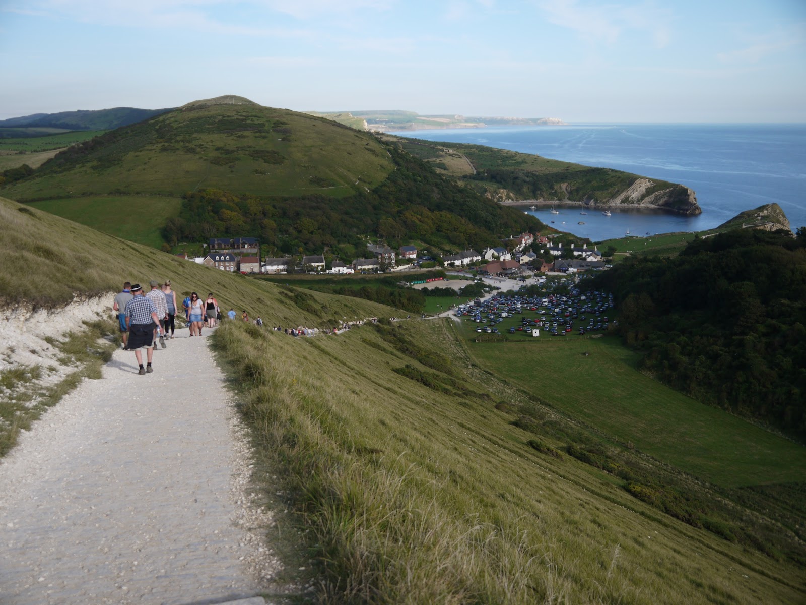
I had one last, but mercifully short climb to make away from Durdle Door before a gentle descent into Lulworth Cove.  This impressive feature is understandably very popular too and a small settlement has built up around it, principally to serve the tourist traffic.  This was a very welcome place to end my journey, since I had plenty of time to have my long awaited ice cream and look around before getting the bus back.  The Cove itself is formed by the sea breaching a hard limestone bed and exploiting the soft shale like rock behind and creating a scallop shaped bay.  In the late afternoon sun it looked most impressive and a great place to end the day’s walking.

Bucket Tree
As I had plenty of time available I wandered along the road towards Lulworth village in order to catch the bus.  It was a welcome way of passing the time, although not really necessary as the bus does serve the Cove itself.  I got a shock when the bus turned up though as it was completely packed to the rafters with Japanese tourists, meaning that I had to stand for the entirety of the lively ride back to Wool Station, approximately 15 minutes away.

Lulworth Cove
This section of the Coast Path is incredibly beautiful and although the transport arrangements are a bit tricky, I felt that the length of time between buses from Wool to Lulworth can be used to your advantage.  I had plenty of time to explore the stretch of path fully and did not feel at all rushed.  This is probably as it should be on such a fantastic section!

Tuesday, 9 October 2012

Weymouth Harbour Tramway


Harbour Station
 After a summer dominated by Olympic and Paralympic activities I had one more place that I wanted to visit before all the decorations came down.  I had deliberately saved the next stage of doing the South West Coast Path for when the Olympics came to Weymouth.  In that regard I was slightly late as the Paralympic Sailing had finished two days before my visit.  However, as it was the day before the Games officially finished I was able to see Weymouth still bedecked in all the Olympic flags before they were taken down.

Redundant Signal

My main focus for the day was to complete the section of coast path from Weymouth to Lulworth but as I was not pressured for time I decided that I would take a look at another former railway before I got going.  This former railway is one with a difference though, since most of the infrastructure is still in place, including stations, track and signalling!  In fact I am not even sure that the Weymouth Harbour Tramway has ever closed, although no trains have run over it since 1999.  Theoretically the line could be used again with a minimum of preparation work, although it looks increasingly unlikely since the local Council has asked for its removal and Network Rail have not contested the request.  The ferry dock is also currently closed, while repairs to some serious structural problems are resolved.  The long term future of the port must be in question after the ferry service decamped to Poole for the entire 2012 season.  Nothing came of an attempt to reinstate the tramway as a transport route for the Olympics and this probably represented the last realistic chance of a revival.

Weymouth Marina

I arrived on the train at Weymouth Station and it was immediately obvious that trains that had gone to meet with the ferries must have reversed out of the main station or by-passed it entirely, since the junction is just north of the throat of the platforms.  This section is the only part of the entire line that is not embedded into the roadway and is pretty overgrown.  With some fairly recent retail development on one side, I should imagine that retaining this narrow corridor of rail was probably quite a nuisance.  It is still controlled by a colour light signal, albeit these days continually on red.

'New' Curve

Once the tramway enters the road network it is clear that running trains along it now would be fraught with problems.  The first section of road that it travels along is a very busy access road for the town centre and car parks.  The idea that a train crew armed with flags could walk along in front of a train along this stretch of line seems rather ludicrous now, but that is exactly what happened until 1987 when regular passenger services finally stopped.  A few railtours ventured this way in the 1990s, with the last of all in 1999.  An idea of how incongruous the line would be in today's network is illustrated by an excellent film I found on You Tube from 1994

Open for Business

This part of the railway is probably the least interesting now, as apart from the tracks embedded in the road there is little of the original character of the line left.  I crossed the road and took a look at the old 1930s bridge that would once have brought town centre traffic into Weymouth.  While it still looks in pretty good shape, its former importance has now been taken from it and the bridge now has a rather melancholy air.

Town Bridge

Further down the road and the old line takes a wider curve around the harbour wall.  Apparently the curve here was eased slightly back in 1938/39 to enable better rail adhesion.  A set of points are still in place, although I am not sure that the second line was anything more than a siding.  I suddenly became aware of how much boat movement there was in the marina as I rounded the corner as it soon became clear that the queue of boats were waiting for the lifting bridge to be opened.  I am not sure if this is by demand or at a scheduled time, but clearly there were plenty wanting to get out on such a sunny day! 


Weyfish

I watched the bridge open with a degree of fascination and the queuing boats all passed through fairly slowly in convoy fashion.  I should imagine that this bridge could cause some serious hold ups – no wonder that other bridges have now been made available.

The George Inn

The next part of the tramway is the one most photographed from operational days.  The route passes along the quayside on the narrow road in front of the former fisheries and harbour buildings, many of them now converted to other uses such as restaurants and pubs.  The harbour still has something of a buzz about it though, with plenty of fishing boats still lined up.  With the added dimension of the Olympics and all the decorations that came with that, I thought that the old place still looked really good.

Sharkys

Eventually I came upon the Harbour Station.  The first part of it was a platform only on one side of the double track formation.  I think this platform would originally have been used for transferring goods from ship to train, as tomatoes and other fresh produce from the Channel Islands was once brought in through this port.  The main passenger station is just beyond and adjacent to the ferry terminal where cross channel ferries once left from.  The only French service that has operated in recent years has been an extension of the Channel Islands service, presumably because of the difficult access for vehicular traffic.  However, Condor Ferries ran a seasonal Channel Island service from the port until 2011.  The port is temporarily closed now after the discovery of some very large cracks in the quayside, which rendered the terminal as unusable until repairs are effected.  Given the scale of the cost of repair, the long term future of the port must be in doubt.

Harbour Master's Office

Whatever the future as a ferry port, the station itself has been mothballed for 25 years.  Yet despite the length of time that has elapsed since the final services ran, the station itself is in remarkably good health.  Maybe it is because of the sea air that suppresses weed growth, or maybe because of maintenance, but the station is still pretty weed free.  It is obviously derelict though and would take some investment to get going again.  How long this station will remain in this state is anybody’s guess.  I would imagine that the showcasing that Weymouth got during Olympic year, inward investment may result and places like this that aren’t earning their keep must surely be ripe for redevelopment.

Goods Platform
Weymouth and Portland Council took over the line in 2009, stating that they wanted to close it since there were no viable plans for its use as a railway.  Since acquiring the trackbed though there seems to have been no plans brought forward.  It remains an oddity of the national rail system, but for how much longer?

Olympic Decorations

Monday, 1 October 2012

Mayor of London Discovery Trails - Blue Route

Tower Bridge
After completing the Yellow Route of the Mascot Trails we still had enough time left to complete the last route as yet unexplored – the Blue Route.  This turned out to be possibly the longest route of all (although the official length was slightly less than the Red Route – didn’t seem like it!).  We headed down to London Bridge Station so that we could find the start of the route near to Tower Bridge.  This walk promised much as we would see the famous sights of Tower Bridge, HMS Belfast, the Modern Tate, Millennium Bridge, St Paul’s Cathedral, the Monument and The Tower of London.

City Hall
The river looked at its very best as we found our way onto the riverside walk.  Because the start point wasn’t near a Tube Station we had to along to the start of the route just outside City Hall.  This is a curious looking building as it looks like a slinky toy that has been knocked over slightly.  The first mascot was just across the way from the building and was ‘Skyline Mandeville’; a celebration of the new-found confidence in the city that is causing the building of lots of new and distinctive looking high rise buildings.  This part of the riverfront was very busy, with many people drawn to the large screen that had been provided for the Paralympics.  Tower Bridge looked resplendent with the Paralympic Symbol, which had replaced the Olympic Rings the week before.

Skyline Wenlock
We headed upstream along the river front, soon coming to the next mascot which was Maritime Wenlock, positioned outside London Bridge City, where much of London’s cargo trade was once housed.  As with just about all the dockside stuff this has now been gentrified and turned into another use – in this case a very attractive looking and well appointed shopping arcade.  The star of this part of the riverbank is undoubtedly HMS Belfast though.  This veritable old warship looks better than ever, thanks to recent renovations.  I made a mental note to take a visit one day as this World War II veteran has a fascinating history.

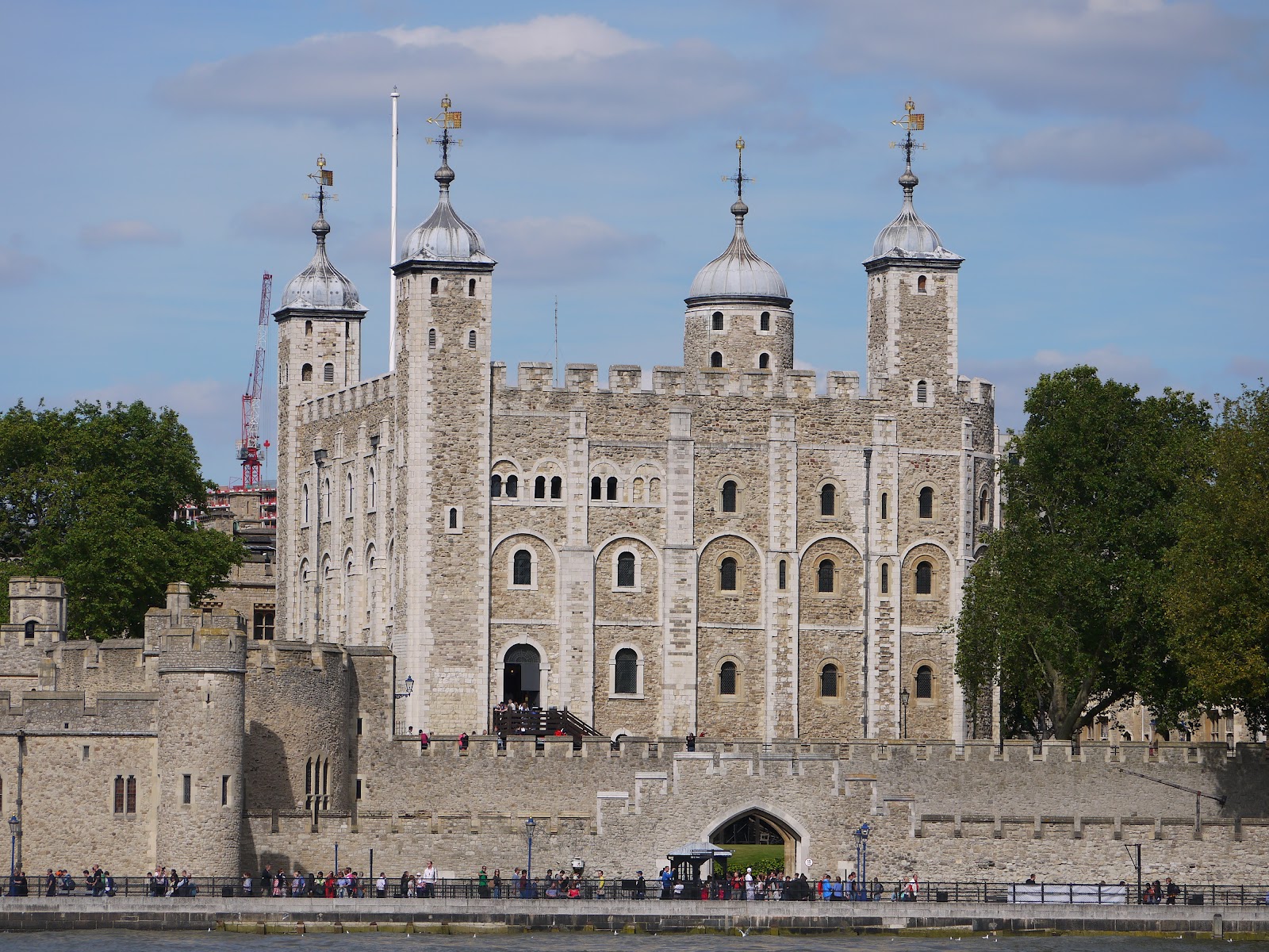
Tower of London

At London Bridge our route departed from the riverbank for a short distance and we passed by one of the least known cathedrals in the UK let alone London, the rather attractive one at Southwark.  The contrast between this old church and the enormity of the recently opened Shard Building behind was quite amazing.  Surprisingly, although the church is very old (some say parts of it are 1000 years old), it did not become a Cathedral until 1905 when the diocese of Southwark was created.  We didn’t have time to go inside sadly, although I understand it has starred in a number of films over the years due to its interior beauty.  Outside the cathedral was the appropriately decorated Cathedral Wenlock.

HMS Belfast

We pushed on past a museum devoted to Prison Life (there seems to be a lot of interest in these dark subjects in London) and then a mock up of The Golden Hind, the flagship of Captain Drake, the first ship’s captain to successfully circumnavigate the globe (although Magellan’s crew had previously done it, the captain himself was killed on the way round).  By the ship was the next mascot, Pirate Wenlock.  Since many people think of Sir Francis Drake as little more than a pirate, this again was quite an appropriate choice.
Southwark Cathedral and The Shard

After passing the Golden Hind, the crowds dissipated for awhile as we headed under the railway bridge carrying tracks across to Cannon Street Station, the nearest to the Bank of England and something of a commuters hub that is a lot less busy at the weekend.  The old station is nothing like as grand as it used to be, with its former glass overall roof being replaced by more remunerative offices and shops on the upper stories.  Only the two towers that flanked the glass roof remain, standing out like beacons amidst rather more uninspiring architecture.  As this was a Friday the bridge was busy with trains, although the station itself is closed on most Sundays.  Having been under many threats of closure since the War it is perhaps gratifying that the station is here at all still.
Pirate Wenlock

Just the other side of the bridge and we passed by Rainbow Mandeville, a duplicate design to the Rainbow Wenlock in Regent’s Park, showing how the four nations of the UK were being brought together to help deliver the Games.  As we headed westward the crowds started again and we soon realised that we were approaching the Globe Theatre, the replica of the original Shakespeare Theatre that was burned down after a stage accident and then pulled down by the Puritans in 1644 following its rebuilding.  The new Globe Theatre is a short distance from the original as that site is now occupied by other listed buildings!
Cannon Street Station

Outside the Globe was a generic Mandeville, still attracting plenty of attention due to its location.  I did think it was a shame that it couldn’t have been one celebrating Shakespeare’s contribution to the capital.  Just along the way though was Arty Wenlock, at the base of the Millennium Bridge and outside the Tate Modern.  By now the crowds were huge and so we lingered only long enough to get a few pictures of the mascots before heading off across the bridge.  It was our first time on the Millennium Bridge, some 12 years after it first opened and 10 years after the changes that prevented the ‘wobble’ that people experienced as they crossed.  I am happy to report that there is no such wobble now, especially important considering the number of people using it that day.
The Globe

The view across to St Paul’s Cathedral is magnificent and despite the crowds we could see that the design to incorporate this view was really well done.  The views up and down the river were also very good, although we didn’t really have the opportunity to stop and admire due to the weight of foot traffic.
Arty Wenlock

The walk on the north side of the river had a rather different character as it led through the business districts of the City of London.  We passed by St Paul’s Mandeville and Mansion House before taking a loop around the eastern end of St Paul’s Cathedral.  Its dome looked absolutely magnificent in the late summer sunshine.

Millennium Bridge

Below the dome was Telephone Box Wenlock, celebrating the famous old design that has made these 20th century additions to the street landscape so popular.  As we paused to look another old symbol of London, the iconic and original Routemaster bus, now phased out except on a couple of heritage route, including this one.
St Paul's Cathedral

Across the road from St Paul’s in a little hidden corner of seating was Sonnet Wenlock.  Surely this one would have been better placed at The Globe?  By now we were starting to get mascot fatigue and were anxious to finish the trail.  Luckily the next three; City Gent, Giant and Sir were all close to each other – the last being in the courtyard of London’s Guildhall.  This fine old building was one of the few to have been spared during the Great Fire of London and dates from 1441.  It is still used as the ceremonial building for the City of London (not Greater London, of which the City) is only a small part.  Sir Wenlock was also unique in that it was the only one of the mascots not to show the one-eye trademark.  ‘Sir’ had a helmet to complement his suit of armour!

Passing Routemaster
Having ticked off a few in quick succession it was a fair distance to the next mascot stationed at the foot of the Monument.  On the way we passed the ‘Old Lady of Threadneedle Street’ as the Bank of England is sometimes called.  We also passed by some of the most impressive looking Victorian buildings of commerce that surround the Bank.  The feeling of establishment was all around us, but a different atmosphere to that we experienced around Westminster.

Telephone Box Wenlock
The Monument is one of my favourite places in London.  Sadly the old stone column, which was erected in memory of the Great Fire of London in 1666, is now completely surrounded by tall buildings and seems a little lost.  It must have been hugely impressive when it was first erected and even now the view from the top is quite startling, once you have your breath back from climbing the 311 steps that is!  The mascot equally celebrates the Great Fire in which most of London was destroyed but at remarkably small human cost (only six deaths were recorded).  The London that emerged from the ashes was brighter and better, with a street plan that has largely survived to the present day.

London Guildhall
Having found the Monument Wenlock it was a fair trek to the last two, Ravens and Beefeater.  These are probably the most famous residents of the Tower of London; both guarding the old fortress and prison in their own ways.  The mascots drew a lot of attention unsurprisingly, as they were stationed along the perimeter wall of one of the most famous tourist attractions in London.  Strangely though the mascots were reversed from the suggested locations on the map – not sure why.  It did mean though that ‘Beefeater’, which was probably the more attractive of the two had Tower Bridge as its backdrop.
Sir Wenlock

So ended our tours of all the six mascot trails, or ‘Discovery Strolls’ as they were officially called.  We spotted 82 mascots altogether and walked 23km officially across the six trails.  It was a remarkable way of seeing London and while I didn’t think much of the mascots initially I have to say that done up in their various guises I did warm to them.  Possibly it was the brightly coloured artwork that I liked far more than the mascots themselves.  

The Monument
I understand that since the close of the Paralympics’ Games all the mascots have been taken away, but the routes are still worth following, for they will give you a great sense of our Capital City.  The mascots themselves have been auctioned off to raise money for charity, many of them raising five figure sums.  We have to make do with pictures of each one as a reminder of our remarkable summer.  Following the end of this walk we headed off to the Olympic Stadium for a well-deserved sit down and watched the remarkable Paralympics’ athletes put in some great work during an entertaining evening of sport.

Beefeater Mandeville